Yoink!
A land that has been inaccesible for a century for not really understood reasons is starting to become exploreable again, with the ruins and remains only raising further questions.
I want to use that one day.

A challenge with this concept is that there aren't any settlements (human ones, anyway) where the players can get more information about the local area. So you gotta have a good rumor mill in town, lots of information discoverable "in the wild", and/or players who see the value of befriending the monters.
Players don't pay attention to artistic and aesthetic descriptions. My hypothesis is that players are automatically trying to filter out the window dressing and identify the pieces of information that seem relevant to their future decisions. It might not even be that they don't care, but are trying to separate the wheat from the chaff so they don't miss anything important. When you describe things, concentrate on things that players would regard as relevant to what they decide to do next. It's the decorative bits that need to be limited to one or two sentences.
Good point. I think with this hexless style that I was running, it's very hard to do this. If you concentrate on just a few details, players miss out on details for the map, and you risk describing locations inconsistently, which makes navigation even harder for the players. I think there's just altogether too much information that needs to be communicated at once, especially when you're not running the game face to face.
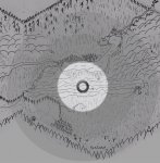
I've read a bunch of blogs that tell you not describe the map in terms of hexes to the players, but the original hex-crawl adventure, X1 gives you a player map with a vast empty interior full of blank hexes. That was frickin awesome! Filling in the blanks one by one is fun and easy to do as opposed to making guesses and scribbling in freeform on a blank piece of paper. What do you do when the characters get lost? start a hex map on another page and transcribe it over to the main map when people finally get pointed in the right direction. Problem solved. But hexes ruin the players' sense of Immersion! Pshaw, whatever, we're playing a tabletop game! Filling in the blanks on a finite map, like mowing the lawn, comes with a deep and satisfying sense of accomplishment.
I totally see that, and ironically as a player I think I'd love that type of campaign. There's definitely a cost in in terms of gaminess vs. immersion, but it might be worth it for clarity's sake. Confused players are generally demotivated players.
It might be good to define the exact nature of a hex, though. There's a lot of advice online already about choosing 1mi vs. 3mi vs. 6mi hexes, but as you pointed out earlier in the thread, even a 1 mile hex can fit a lot of varied locations. The human mind boggles at imagining these spaces. Like I mentioned in my previous post, I like the 3 mile hex, since that implies that on a flat plane, where the distance to the horizon is roughly 3 miles, a party in one hex can see center of all neighboring hexes, and tall landmarks can be seen from x hexes away.
That idea of scale is often discussed from a perspective of realism, but I'm wondering if it really boils down to the question of what a hex represents. Is it somewhere that the players get to and spend time in? Do players abstractly "explore" a hex with a dice roll, as some hex crawl procedures call for? Or does each hex have a concrete representation of the contents within it, ala Courtney Campbell's
Hexplore series?
How much content do you then put in one hex? And how long do you expect the players to spend in one hex?
Another things to consider is the idea of an exploration campaign as one that consists of epic journeys. If that's something you want in your campaign, then you probably want at least a few in-game days to pass each session (it takes a long time to reach Lonely Mountain). If you're running 3 mile hexes, and you use the generally accepted wisdom that a party can travel 24 miles a day, then that's potentially 8 "decision points" every in-game day, where they have to decide which direction to go. Taken to the extreme, a session lasting an in-game week would then have 56 of these decisions that players have to make, leaving little time for actual dungeon gameplay. Pointcrawls obviously get around this by having paths of variable length from each Point, aka not forcing players to pick a new hex every time they want to move forward. Letting players head in one direction and narratively skipping hexes can do this too, of course.
So there are some interesting things to use from realism, but it creates tedium when strictly adhered to. I'm wondering if there is some value in considering a "scale model" approach, as mentioned in my last post, where for instance 3 miles in game = 1 mile in game. This could give you the "epic travel" scale in game while keeping the landscapes in each hex more easily comprehensible. It might be kinda videogamey (think Skyrim where every Hold is supported by like literally one farm, and a city = 50 NPCs, but the place still feels real), but maybe that's not such a bad thing, if the alternative is overwhelming the players?
Your idea for a wilderness gazetteer sounds really amazing btw - would definitely buy.